
Garmin eTrex SE
4.2Editor score
Water resistant IPX7 rated design
Long 168 hours battery in standard mode
Multi-GNSS support for better accuracy
Navigating the open water requires reliable tools to ensure safety and efficiency on every voyage. A handheld GPS for boating provides essential positioning data that helps captains and crew stay on course even when electronic systems fail.
We evaluated ten leading models based on durability, battery life, mapping capabilities, and satellite connectivity. Our analysis focuses on devices that float resist water and offer intuitive interfaces for critical situations at sea.
Each pick highlights specific strengths like preloaded charts or multi band tracking to suit different boating styles. Prices fluctuate frequently so check current listings before purchasing to secure the best deal available today.
4.2Editor score

4.0Editor score
4.2Editor score
As an Amazon Associate we earn from qualifying purchases.
This side by side comparison outlines the key specifications and capabilities of each top rated model to help you make an informed decision for your marine adventures.




The Garmin GPSMAP 79sc stands out as the top choice for boaters who need reliable navigation right out of the box. It features preloaded BlueChart g3 coastal charts and a rugged floating design that protects against common marine accidents.
We may earn a commission when you buy through this link, at no additional cost to you.
This device supports multiple satellite constellations for accurate tracking around the world and includes a built-in compass that works even when the unit is stationary. The high-resolution color display ensures visibility in bright sunlight while the scratch-resistant glass handles daily wear.
While the IPX6 water resistance rating applies to the unit level only it still provides solid protection against splashes and rain. The price reflects the premium features like preloaded charts and advanced tracking capabilities which justify the investment for serious sailors.
Boaters seeking a dependable marine handheld GPS with essential mapping included will find this model offers the best balance of performance and convenience. It is ideal for coastal voyages where chart access is critical for safe navigation.
The inclusion of BlueChart g3 coastal charts means you do not need to purchase additional mapping to start navigating immediately upon arrival at your destination.
Its rugged construction ensures it can withstand the bumps and falls common on a boat while the floating feature prevents loss if it slips overboard.
We may earn a commission when you buy through this link, at no additional cost to you.
The Garmin GPSMAP 79s is an excellent option for boaters who travel internationally or prefer a lightweight navigation solution with global coverage. It comes with a worldwide basemap that provides essential routing without the need for region specific chart purchases.
We may earn a commission when you buy through this link, at no additional cost to you.
This model shares the rugged floating design of the 79sc ensuring it survives drops and splashes while offering reliable tracking through multiple satellite constellations. The high-resolution color display remains clear in direct sunlight which is vital for safe operation at sea.
While the worldwide basemap lacks the depth of detailed coastal charts it covers most global waterways adequately for general positioning. The water resistance rating is limited to the unit level so care is still needed during heavy rain or immersion.
Travelers who need a versatile handheld GPS for boating that works across different oceans will appreciate the global basemap and durable build. It offers a practical middle ground between basic trackers and premium marine plotters.
The worldwide basemap ensures you have navigational support regardless of which country or ocean you are visiting without needing multiple region specific maps.
By supporting GPS GLONASS Beidou and other systems this device maintains accurate positioning even in challenging environments where single system signals might fail.
We may earn a commission when you buy through this link, at no additional cost to you.
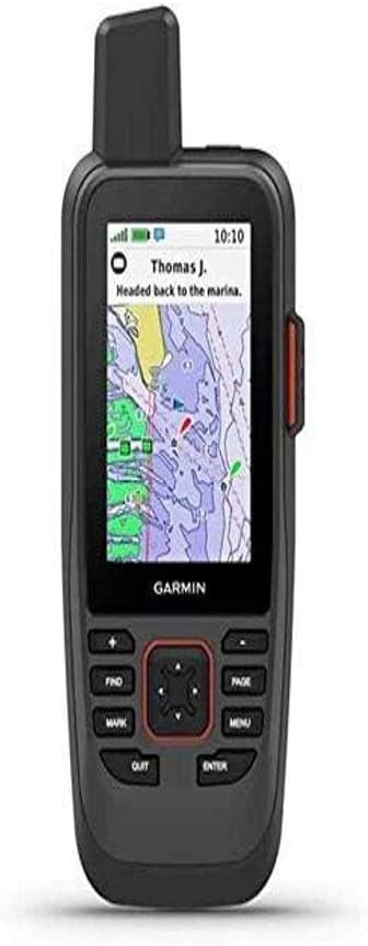
The Garmin GPSMAP 86Sci elevates marine safety and connectivity by integrating InReach satellite communication capabilities directly into the handheld unit. This allows boaters to send two-way text messages and trigger interactive SOS alerts even far from cellular coverage.
We may earn a commission when you buy through this link, at no additional cost to you.
In addition to safety features it can stream boat data from compatible chartplotters to consolidate marine system information on one device. The preloaded BlueChart G3 coastal charts provide essential navigation detail while the floating design protects against accidental drops overboard.
Users must maintain a satellite subscription to access the communication and weather features which adds an ongoing cost to the initial purchase. However the ability to stay connected in remote waters makes this a valuable investment for offshore voyages.
Boaters who prioritize safety and real-time communication will find this premium device offers unmatched utility for long-distance sailing. It combines navigation with global satellite support to keep you informed and connected.
The InReach feature allows for two-way text messaging and SOS alerts via the Iridium network ensuring you can call for help from anywhere on Earth.
Stream boat data from compatible chartplotters and instruments to view consolidated marine information on the handheld unit during your journey.
We may earn a commission when you buy through this link, at no additional cost to you.
The Garmin eTrex 22x is a versatile rugged navigator that works well for boaters who also explore islands or coastal trails on foot. It comes preloaded with Topo Active maps and offers generous internal memory for storing additional map data.
We may earn a commission when you buy through this link, at no additional cost to you.
This device supports GPS and GLONASS satellite systems for reliable tracking in challenging environments and features a sunlight-readable color display for clear visibility outdoors. The long 25 hour battery life ensures it lasts through extended excursions without needing frequent recharges.
While it lacks specific marine charts its robust build and map flexibility make it useful for tracking routes and waypoints during land exploration near water. It is not designed to float so extra care is needed around water edges.
Boaters who need a multi-purpose device for both water navigation and land exploration will find this model offers excellent value. It provides reliable tracking and ample storage for diverse outdoor adventures.
Preloaded Topo Active maps and a micro SD card slot allow you to customize the device with various map types depending on your specific needs.
With up to 25 hours of battery life on 2 AA batteries this device stays powered for long periods of active use in the field.
We may earn a commission when you buy through this link, at no additional cost to you.
The Garmin GPS 73 is tailored specifically for sailors with features like SAILASSIST that include virtual starting lines and tack assist. It offers essential marine alarms such as Man Overboard to enhance safety during sailing activities.
We may earn a commission when you buy through this link, at no additional cost to you.
This model features a 2.6 inch display and dedicated backlit buttons for quick operation in low light conditions. It stores up to 1000 waypoints which is sufficient for marking favorite fishing spots or safe anchorages along your route.
Although it is an older model without a floating design it remains a reliable option for those who prioritize sailing specific tools over general ruggedness. The user interface is intuitive making it easy to use even in rough seas.
Sailors looking for a device with built-in sailing metrics and marine alarms will appreciate the focused functionality of this unit. It provides the core navigation tools needed for competitive or recreational sailing.
The SAILASSIST feature includes virtual starting lines countdown timers and tack assist to help you optimize your performance during races or leisurely sails.
Built-in marine alarms like Man Overboard and anchor drag alerts provide instant notifications for critical situations that require immediate attention on the water.
We may earn a commission when you buy through this link, at no additional cost to you.
The Garmin GPSMAP 79sc Renewed offers the same premium features as the new version at a more accessible price point for budget-conscious boaters. It includes preloaded BlueChart g3 coastal charts and a rugged floating design for reliable performance on the water.
We may earn a commission when you buy through this link, at no additional cost to you.
This certified refurbished unit undergoes inspection to ensure it meets quality standards while delivering the same tracking accuracy and display quality as a brand new device. The floating feature and water resistance provide essential protection against marine hazards.
While minor cosmetic wear might be present it does not affect the functionality of the navigation or mapping features. The warranty coverage may vary depending on the seller but often provides sufficient protection for typical use.
Boaters who want a top-tier GPS without paying full retail price will find this renewed option an excellent value. It combines high performance with cost savings for practical navigation solutions.
Choosing a renewed device allows you to access high-end marine features at a fraction of the cost of a brand new unit without compromising functionality.
This renewed unit has been inspected to meet quality standards ensuring that it functions like new for all navigation and tracking needs.
We may earn a commission when you buy through this link, at no additional cost to you.
The Garmin GPSMAP 65 utilizes multi-band technology to deliver optimal accuracy in challenging locations such as steep canyons or dense forests. It features a large 2.6 inch sunlight-readable color display that ensures visibility in bright conditions.
We may earn a commission when you buy through this link, at no additional cost to you.
This device includes routable TopoActive mapping for land routes and is compatible with the Garmin Explore website and app for managing tracks and waypoints. The expanded global navigation satellite systems support enhances connectivity and precision.
While it does not include marine specific charts or waterproofing it is a powerful tool for tracking positions when docked or exploring nearby coastlines. The button-operated design allows for easy use even when wearing gloves.
Boaters who need precise tracking in variable environments will find the multi-band technology invaluable for maintaining a strong signal. It offers advanced connectivity features that enhance navigation reliability.
Multi-band technology allows the device to access more satellite frequencies for optimal accuracy in challenging locations where single band might struggle.
Connect with the Garmin Explore website and app to manage tracks routes and waypoints and review statistics from the field.
We may earn a commission when you buy through this link, at no additional cost to you.
The Garmin eTrex 32x offers robust mapping capabilities with a 3-axis compass and barometric altimeter for detailed navigation. It comes preloaded with Topo Active maps and includes 8 GB of internal memory for additional data storage.
We may earn a commission when you buy through this link, at no additional cost to you.
Support for GPS and GLONASS satellite systems allows for tracking in more challenging environments than GPS alone ensuring reliable positioning during coastal trips. The sunlight-readable color display ensures visibility when checking your position under bright skies.
This device is designed primarily for land exploration and lacks waterproof or floating features so it requires care near open water. Its strength lies in its detailed mapping and long battery life which supports extended field use.
Boaters who need a reliable companion for detailed land mapping and long battery endurance will appreciate this rugged navigator. It offers essential tools for tracking routes in remote areas.
The addition of a 3-axis compass and barometric altimeter enhances navigation precision by providing accurate heading and altitude readings.
With 8 GB of internal memory and a micro SD card slot you can download and store extensive map data for various regions.
We may earn a commission when you buy through this link, at no additional cost to you.
The Garmin eTrex SE delivers exceptional battery life and water resistance in a compact affordable package ideal for casual boaters and hikers. It features a high-resolution display that remains readable in bright sunlight and offers Multi-GNSS support for accurate positioning.
We may earn a commission when you buy through this link, at no additional cost to you.
With up to 168 hours of battery life in standard mode it can support extended trips without needing frequent battery changes. The water-resistant design rated IPX7 ensures it can handle splashes and rain without issues.
While it lacks advanced marine features it provides essential navigation tools and wireless software updates when paired with a smartphone. Its simple interface makes it easy to use for quick positioning checks.
Boaters on a budget who need a reliable GPS for general tracking will find this model offers excellent value. It balances cost with essential features for basic navigation needs.
The long battery life of up to 168 hours in standard mode means you can rely on the device for extended periods without needing new batteries.
Water-resistant design rated IPX7 allows you to hike or navigate in any weather without worrying about rain or splashes affecting functionality.
We may earn a commission when you buy through this link, at no additional cost to you.
The Garmin GPS 76 offers a straightforward solution for basic navigation with a WAAS enabled GPS receiver that tracks up to 12 satellites. It includes a trip computer with current and average speed which is useful for monitoring your movement on the water.
We may earn a commission when you buy through this link, at no additional cost to you.
This model provides simple functionality without advanced mapping which keeps the unit easy to use and affordable. It supports up to 16 hours of use on 2 AA alkaline batteries ensuring it lasts through a day on the water.
Lack of detailed maps means you must rely on external tools for planning but the device works well as a positioning tracker. Its intuitive interface makes it accessible even for those with limited GPS experience.
Boaters who need a simple and affordable way to track position and speed will find this device meets their basic needs effectively. It is reliable for basic tracking without extra features.
WAAS enabled GPS receiver allows continuous tracking and use of up to 12 satellites for improved positional accuracy in open areas.
Trip computer with current and average speed timer and trip distance helps you monitor your journey progress and speed during navigation.
We may earn a commission when you buy through this link, at no additional cost to you.
Selecting the right GPS involves considering several factors that affect performance safety and usability on the water.
High quality marine maps are essential for safe navigation. Look for devices that include preloaded coastal charts like BlueChart to avoid buying maps later. These charts provide depth contours and hazard markers critical for avoiding shallow areas. Without them you may need to rely on paper charts which can be cumbersome to manage.
Prioritize models with detailed marine maps to ensure you have the data needed for your route.
On the water your device faces splashes and accidental drops so durability is critical. Devices that float prevent loss if they slip overboard. Water resistance ratings like IPX6 or IPX7 protect against rain and immersion. A rugged housing withstands the bumps of boat life. Choose a model that matches the conditions you typically encounter.
Ensure the device has robust water resistance and a floating design to survive typical boating hazards.
Long battery life ensures your device stays active through extended outings. AA batteries are easy to replace which is a plus if power fails. Look for models offering at least 20 hours of operation to cover a full day. Some devices offer power saving modes to stretch runtime further. Always carry spare batteries for safety.
Select a unit with long battery life and replaceable batteries for reliability on extended trips.
Multi-GNSS support allows access to multiple global satellite systems like GPS GLONASS and Galileo. This improves accuracy especially in challenging environments with tree cover or steep terrain. Look for devices that support SBAS for enhanced precision. Strong satellite reception ensures you get a quick lock on your position. Accurate tracking is vital for avoiding drift.
Choose a device with multi-satellite support to maintain reliable positioning anywhere.
Your display must remain clear in bright sunlight so look for sunlight-readable screens. Color displays are easier to read than monochrome options when checking charts. A size of at least 2.2 inches provides enough detail without being bulky. Anti-glare coatings help reduce reflections during the day. Ensure the screen remains visible during peak sun hours.
Opt for a sunlight-readable color display to maintain clear visibility under bright conditions.
An intuitive interface allows you to navigate settings quickly without distraction. Dedicated buttons can be easier to operate than touch screens when wet or wearing gloves. Clear menus help you access key features like waypoints or routes easily. Avoid complex setups that require time to learn when you need to move. The device should adapt to you not the other way around.
Look for an intuitive interface with buttons that make operation simple in any condition.
Some premium models offer satellite communication for messaging and SOS alerts. This is valuable for remote offshore trips where cellular service is unavailable. Check if the device requires a separate subscription for these features. The ability to send location data adds a layer of safety for long voyages. Safety connectivity should be part of your decision.
Consider satellite communication features if you travel far from cellular coverage for safety.
Balance upfront price with the value provided by included maps and features. Devices with preloaded charts save you from buying add-ons later. Renewed units may offer significant savings for similar functionality. Factor in any required subscriptions for advanced communication services. Total cost of ownership matters more than the initial sticker price.
Evaluate the total cost including map purchases to understand the true investment.
Before heading out ensure the device has updated maps and battery life to handle your planned route. Charge internal batteries or insert fresh AA batteries. Test the GPS signal lock on land to verify performance. Check that the compass is calibrated if required by the model.
During your voyage keep the device in a secure spot away from direct sun to prevent overheating. Use the compass and waypoint markers to track progress and avoid drifting off course. If you drop the device in water retrieve it immediately and rinse with fresh water if saltwater was involved.
After your trip rinse the unit with fresh water to remove salt and moisture. Dry it thoroughly before storing it in a dry place to prevent corrosion. Regularly update the firmware via a computer or app to ensure features remain current. This routine helps prolong the device life and maintain accuracy.
Yes handheld GPS devices work effectively on water as they provide accurate positioning via satellites. Marine specific models often include charts and waterproofing for extra safety. Regular devices can function well too but lack specific marine markers. Ensure the device is protected from splashes or immersion.
A floating design is highly recommended for boating to prevent loss if the unit drops overboard. While not strictly necessary it offers peace of mind in rough waters. Most modern marine handhelds include this feature for practicality. If you choose one without it secure it with a lanyard.
Preloaded marine charts are important because they provide detailed depth contours and hazard warnings essential for safe navigation. Without them you may need to purchase separate maps which adds to cost. Having them built in allows you to navigate confidently right after purchase. It simplifies setup and reduces planning time.
Yes many handheld GPS devices are versatile enough for hiking and land exploration too. Models with topographic maps support a range of outdoor activities. However marine specific models may not have detailed land road data. Choose a hybrid model if you plan to explore both land and water.
AA batteries are commonly recommended for handheld GPS because they are easy to replace during trips. Some models use rechargeable Li-ion batteries which save money over time. Always check the device specs to confirm compatible battery types. Carrying spares ensures you do not lose navigation due to power loss.
Most handheld GPS devices do not require a subscription to track location or view basic maps. However advanced communication features like satellite messaging often need a subscription. Always check the device specifications before purchase to avoid unexpected costs. Basic navigation functions typically remain free without any fees.
The Garmin GPSMAP 79sc and 86Sci lead the list with preloaded charts and advanced communication tools. For budget options the eTrex SE offers solid reliability without compromising core tracking features.
Prioritize durability water resistance and map quality when selecting a device for your vessel. These features directly impact safety and ease of use during long voyages.
Always verify current pricing and availability before purchasing to ensure you get the best value. Your navigation tools are critical for safe adventures so choose wisely based on your needs.